
Today’s posts from our featured Port Elizabeth Blogger:
The Noordhoek dune field by Port Elizabeth Daily Photo:
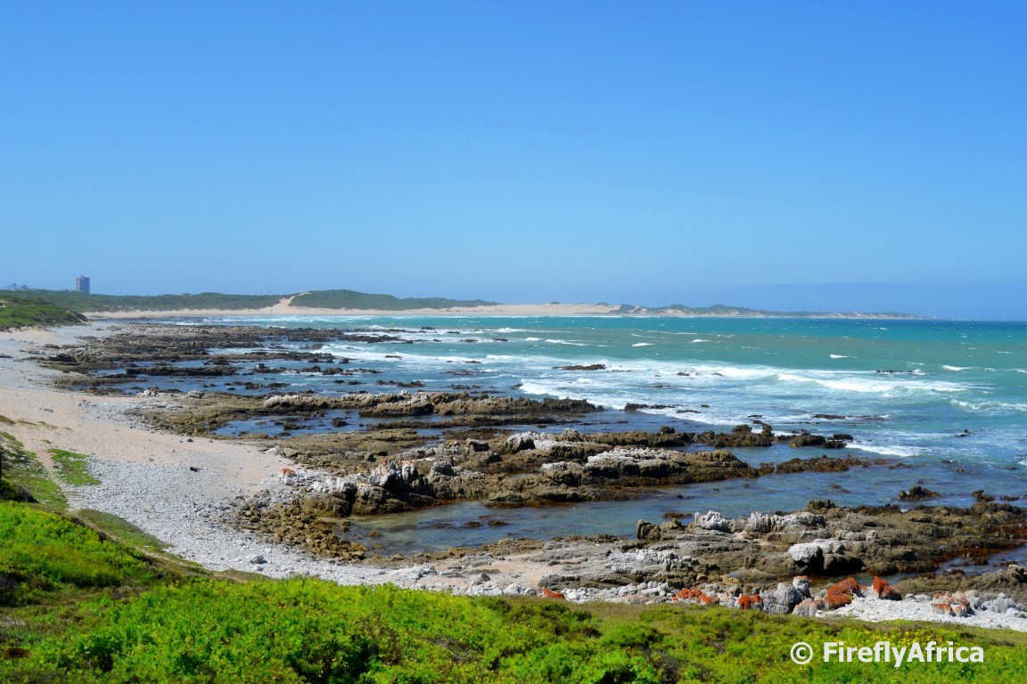
Standing at the view point on Marine Drive close to Noordhoek looking back at Cape Recife you can see a section of sand dunes in the middle of the coastline. These dunes form part of the Noordhoek dune field, one of three driftsand bypass systems that used to take sand into Algoa Bay. The other two are the Drifsands and Cape Recife dune systems.
The main sand bypass, known as Dritsands, covered the whole area between Schoenmakerskop and Summerstrand. In the late 1800’s the dunes started to threaten Port Elizabeth and plans had to be made to stabalise them. At first a steam train was used to dump the town’s garbage on the dunes and you still find areas where pieces of old bottles, plates and other objects can be found. In the beginning of the 1900s the area was stabilised by planting Australian wattles such as Rooikrans and Port Jackson as well as Eucalyptus trees planted in an attempt to start a commercial forest. This stopped the Driftsands dune field from moving sand into the bay.
In the 1960’s the municipality built sewerage maturation ponds in Cape Recife. These fell right into the path of the moving Noordhoek dune field and a decision was made to stabilised the leading edge of the dunes by planting vegetation. From the angle of the picture the back end of this dune field can be seen.
Before the reclamation of Driftsands, about 170000m3 of sand got deposited into Algoa Bay and onto the beaches every year. After Driftsands was reclaimed, the sand entering the bay from the remaining two dune systems dropped to around 78000m3 a year. This again dropped to only 26000m3 a year after the Noordhoek dune field was stopped in its tracks. The only sand being deposited into the bay now is from the small Cape Recife dune field next to the lighthouse.
Read more here: Port Elizabeth Daily Photo
Then and Now – Top of Whites Road by Port Elizabeth Daily Photo:
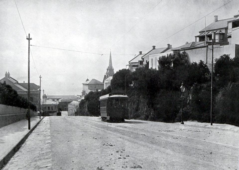
The Port Elizabeth tramway network was opened on 14 May 1881 and was initially operated horse-cars. On 16 June 1897 the network was converted to electrical power and the system operated until it was closed on 17 December 1948. One of the most challenging parts of the tramway network was going up Whites Road past the Opera House. Apparently at one stage boys with buckets of sand used to throw sand on the line to give the trams more grip going up the hill.
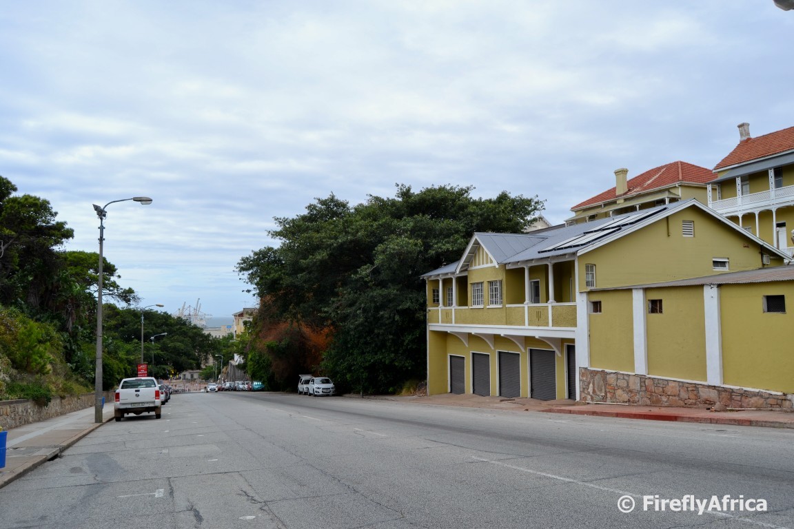
Looking down Whites Road today it’s all cars (ok, so not at the moment of taking this photo) and no more trams. Both the Opera House and St Augustine’s are blocked by trees but still there. At least the buildings top right are still recognisable from the Then picture to Now.
Read more here: Port Elizabeth Daily Photo
Click HERE to submit your blog to be part of this daily feature.
CLICK HERE to get a daily digest of PE Goodness straight into your inbox with the MyPE Monday to Friday Newsletter.
The following two tabs change content below.

Port Elizabethan
This author is a 'catch-all' for occasional articles and letters written to MyPE. The Author of each article can be found in the signature at the bottom of each individual article.
Latest posts by Port Elizabethan (see all)
- Why Fewer People Are Being Convicted for Commercial Crimes - 15 May 2026
- Urgent Call for South Africa to Support and Join Global Efforts to Phase Out Fossil Fuels - 15 April 2026
- Unfenced 6 SAI Army Base Outside Makhanda Claims Another Life - 20 November 2025
- Death Toll Rises From Makhado Bus Crash - 21 October 2025
- Law Clinics Flooded as Home Affairs Blocks Asylum Seekers From the System - 15 October 2025
