
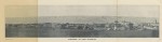
This Port of Port Elizabeth image is courtesy of Flickr. Click on the Flickr account holder below the photograph to see more. Image taken from page 18 of 'The Guide to Port Elizabeth. Illustrated' Image by The British Library Image taken from: Title: "The Guide to Port Elizabeth. Illustrated", "Appendix" Shelfmark: "British Library HMNTS 010096.e.69." Page: 18 Place of Publishing: Cape Town Date of Publishing: 1894 Publisher: Dennis Edwards & Co. Issuance: … [Read more...] about Early panorama of Port Elizabeth
taken
Early Map of Port Elizabeth
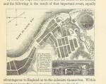
This Early Map of Port Elizabeth image is courtesy of Flickr. Click on the Flickr account holder below the photograph to see more. Image taken from page 227 of 'The Cape of Good Hope and the Eastern Province of Algoa Bay, &c., &c., with statistics of the Colony ... Edited by Mr. Joseph S. Christophers. [With a map.]' Image by The British Library View this map on the BL Georeferencer service. Image taken from: Title: "The Cape of Good Hope and the Eastern Province of Algoa … [Read more...] about Early Map of Port Elizabeth
PE Image – Image taken from page 113 of ‘The Guide to Port Elizabeth. Illustrated’

This Port Elizabeth image is courtesy of Flickr. Click on the Flickr account holder below the photograph to see more. Image taken from page 113 of 'The Guide to Port Elizabeth. Illustrated' Image by The British Library Image taken from: Title: "The Guide to Port Elizabeth. Illustrated", "Appendix" Shelfmark: "British Library HMNTS 010096.e.69." Page: 113 Place of Publishing: Cape Town Date of Publishing: 1894 Publisher: Dennis Edwards & Co. Issuance: … [Read more...] about PE Image – Image taken from page 113 of ‘The Guide to Port Elizabeth. Illustrated’
